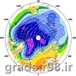
basemap.gs
This is documentation for basemap.gs, a Grads script that overlays a land or ocean mask that exactly matches the coastal outlines of the three Grads map files: lowres, mres, and hires. Basemap works by overlaying polygons on top of an existing display; once they are all drawn, the polygons appear as a solid region that covers the land or ocean areas. Basemap does not actually mask the data, it only masks the display of the data.
Syntax
basemap.gs L(and)/O(cean) <fill_color> <outline_color> <L(owres)/M(res)/H(ires)>
The land and ocean masks are composed of hundreds of polygons that are specified in accompanying ASCII files. The ASCII files must be downloaded from the Grads script library. Once you have downloaded these files and stored them in a convenient location, you must update your copy of basemap.gs to include the path of the location of these files. The script will not work without these files.


 set yflip Flips the order of the vertical axis
 HDF View Version 3.2.0 Free Download 2022